

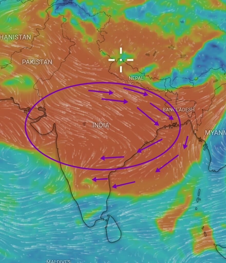
After a week of widespread moderate to heavy rains across Tamil Nadu and southern Andhra Pradesh, rainfall activity is set to decrease. This is due to high-pressure axis moving down from central India over Tamil Nadu, leading to relatively drier conditions, especially in northern and central parts of Tamil Nadu.
The delta districts and coastal areas of southern Tamil Nadu will continue to experience scattered rainfall over the next 2-3 days due to moisture incursion, which will reduce thereafter.
What’s Next?
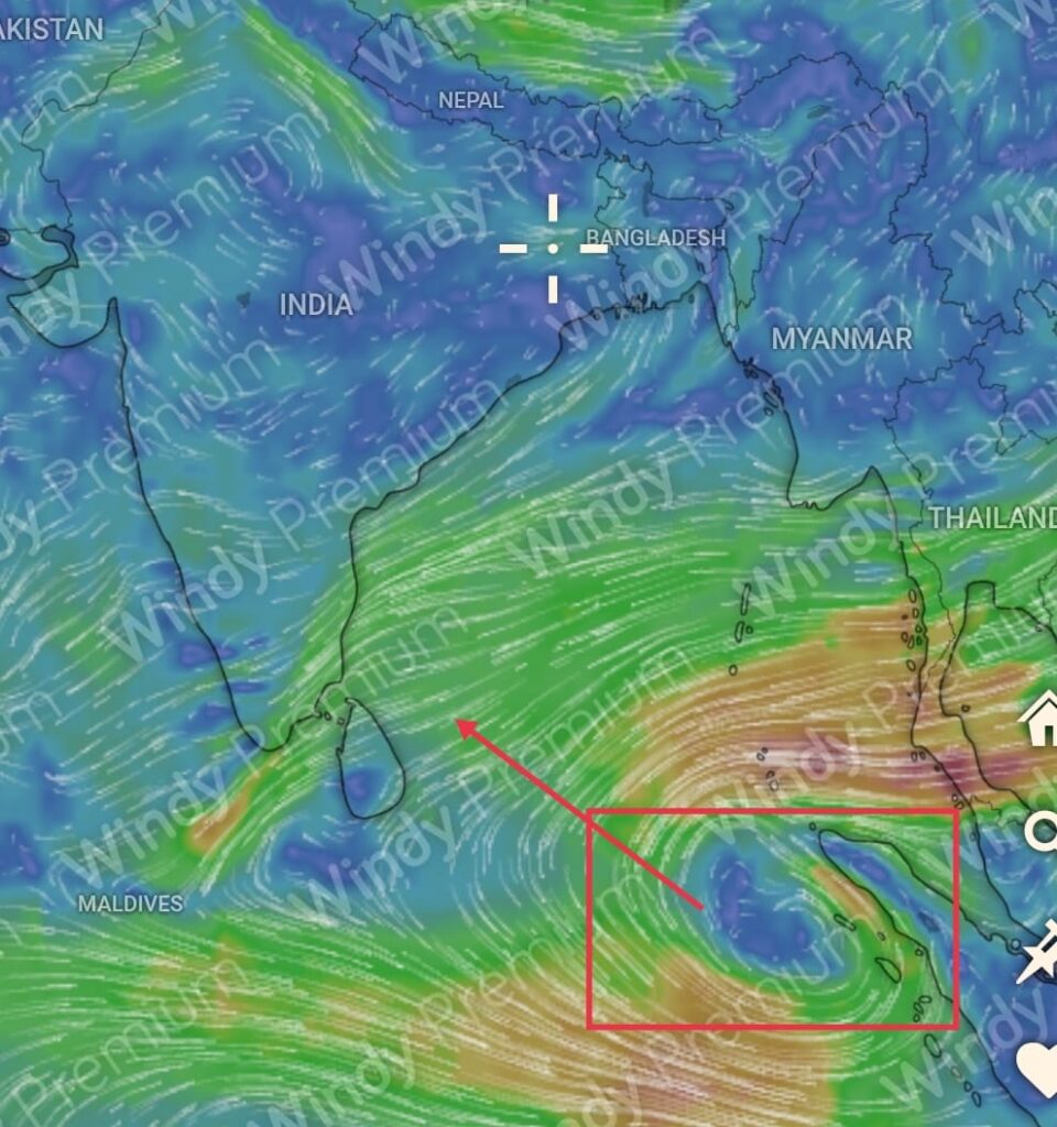
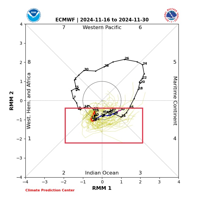
With the MJO (Madden-Julian Oscillation) entering Phase 2, enhanced rainfall activity is likely over South Peninsular India starting around November 25th. Numerical weather models indicate the possible development of a low-pressure area near the Sumatra coast. This system has the potential to intensify into a Depression/Cyclone and move closer to Tamil Nadu coast around November 26-27th.

Further updates will be provided as the event approaches.