

The depression off the Tamil Nadu coast made landfall just north of Chennai as a weakened system, having lost its structure due to wind shear. Despite this, the system brought widespread, heavy rainfall across parts of Tamil Nadu and Andhra Pradesh. Some areas in Chennai recorded up to 300mm of rain within 36-48 hours, meeting the city’s average rainfall for October.
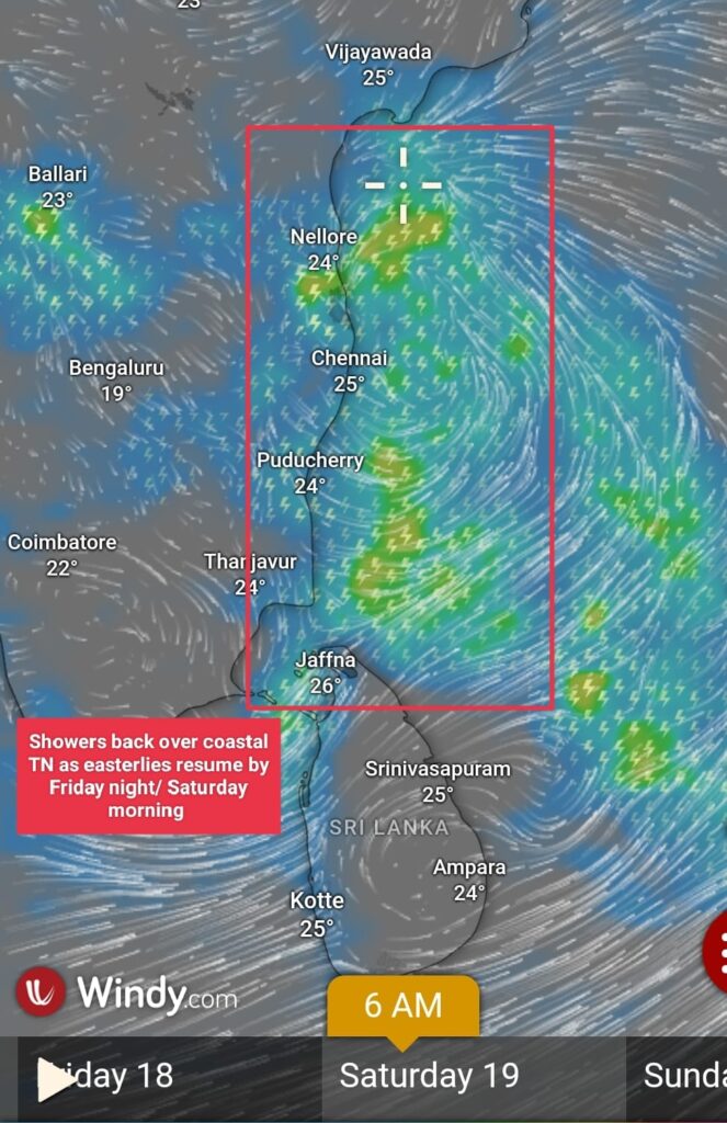
Showers to resume:
As the depression has weakened, easterly winds are expected to resume by tomorrow night, bringing the typical early morning and late-night showers to coastal Tamil Nadu and Afternoon T.storms to interiors.
Upcoming disturbance:
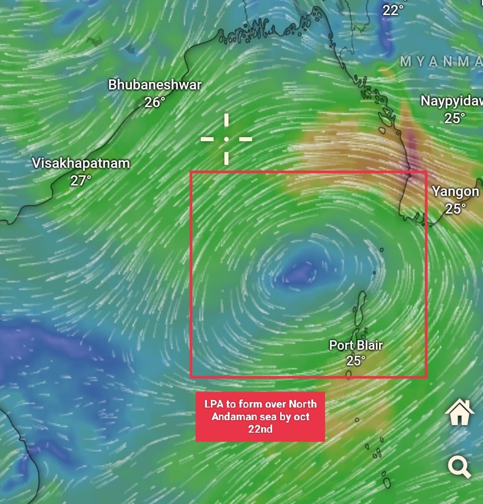
Looking ahead, numerical weather models are predicting the formation of a low-pressure system over the North Andaman Sea, which could develop into a depression and move towards the Odisha coast due to the positioning of the ridge.But it is too early to say regarding the system movement. We are closely monitoring this and will provide updates as the system evolves.
Northeast monsoon update:
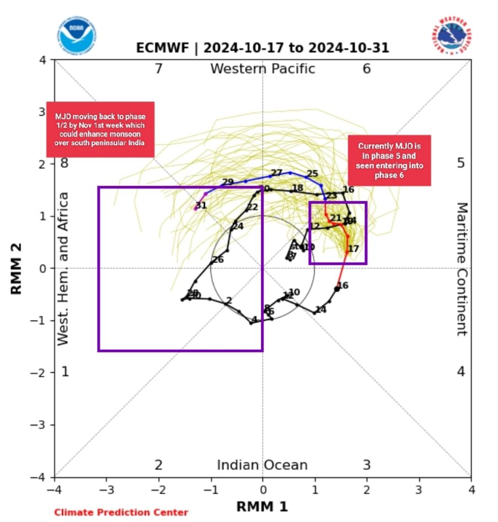
Currently, the Madden-Julian Oscillation (MJO) is in phase 5/6, indicating a period of suppressed rainfall for South Peninsular India. However, long-range forecasts suggest that the MJO may shift back into phase 2/3 (Indian Ocean) by the end of the first week of November, potentially reactivating the monsoon over southern India. More details will be shared as forecasts become clearer.