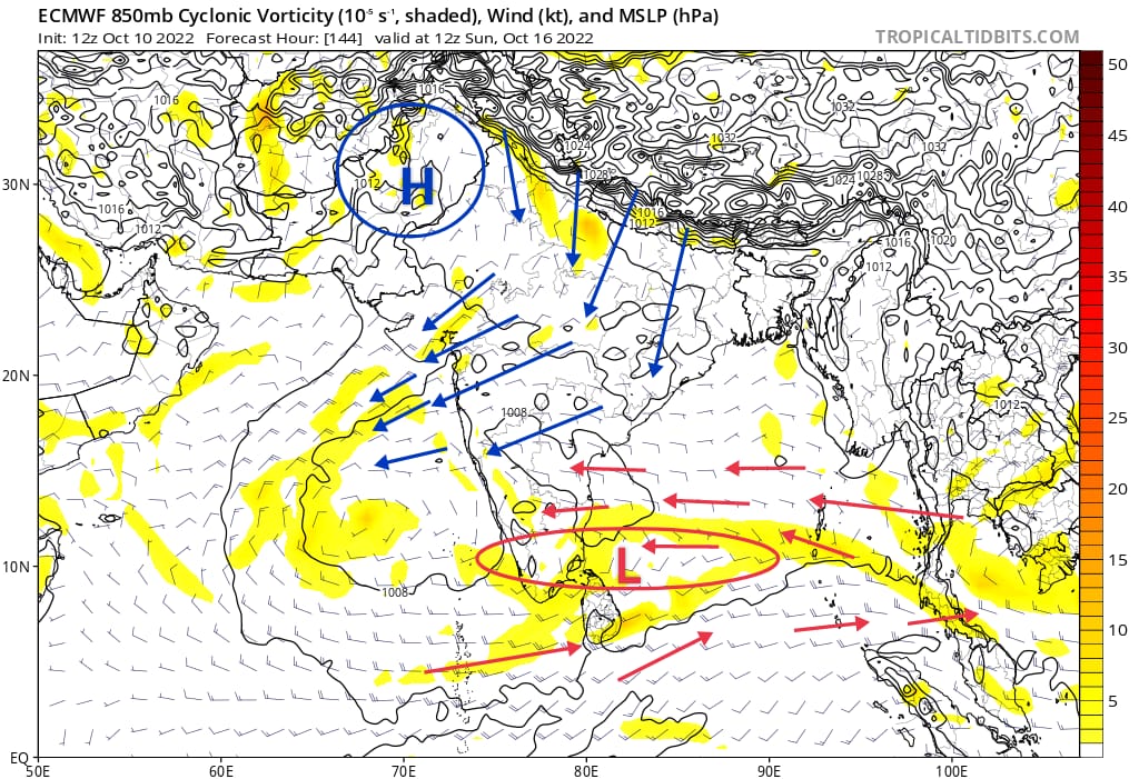
As per Numerical weather models the has come to bid adieu westerly winds over TN . Easterlies ( winds from sea) have set in over Tamilnadu and AP. From now on there won’t be westerly winds for next 6 months unless any system moves above us ( that too it will be only for temporary period)
With East-West trough/shear zone embedded in itcz establishing over Bay of bengal adjoining Arabian sea , a circulation or Inverted trough might develop which will significantly increase rainfall activity and could bring widespread rains over coastal areas of Tamilnadu including ktcc districts from 15th of October.
Onset of Most awaited NEM season will happen between 16-20 October over Tamilnadu and South Andhra Pradesh.
First system of NEM 2022:
First system of Northeast monsoon 2022 will emerge from east-west shear zone by 23rd October . Its path , intensity will be decided based on the atmospheric conditions of that time period. As of now most models are projecting it to move towards AP waters. Its too early to say now. Lets wait and track.
Weather forecast for next 48 hrs for Tamil Nadu.
With moisture incursion from southerly winds scattered spells of rains likely over many places in Tamilnadu. Interior areas will see rains during afternoon to evening time while coastals will witness spells during Late night to morning time
Chennai City and adjoining areas will witness the same pattern mentioned above.