
Extreme Rains lash STN, Bay under watch for Low Pressure formation
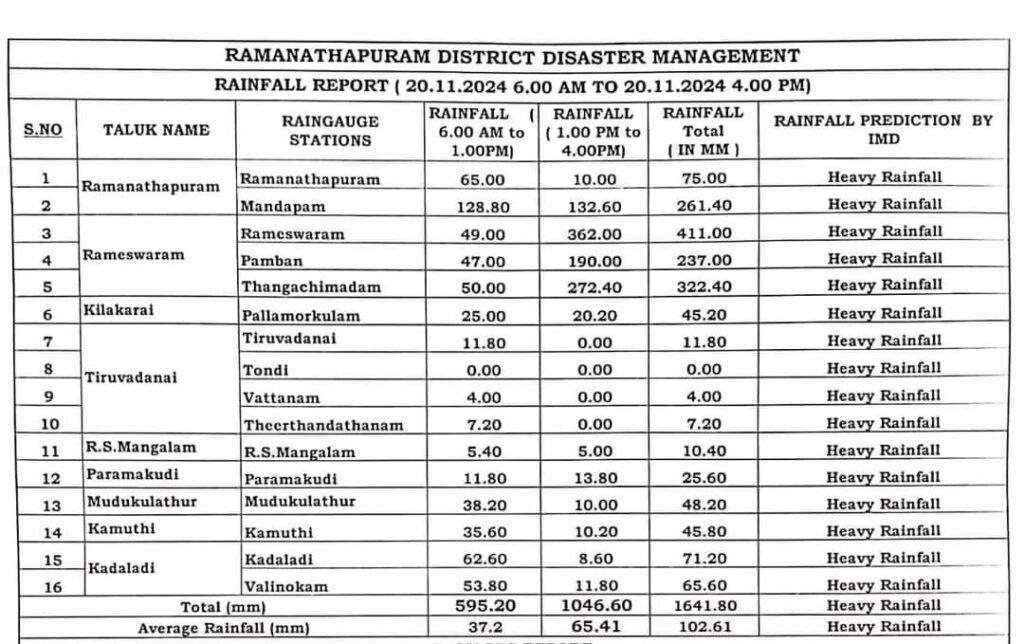
Heavy rains have battered the coastal areas of South Tamil Nadu due to an upper air circulation over the Comorin Sea and the associated convergence of easterly winds. Rameswaram recorded a staggering 41 cm (410 mm) of rainfall in just 12 hours, while Mandapam has saw 32 cm and Pamban registered 23 cm of rainfall during the same period.
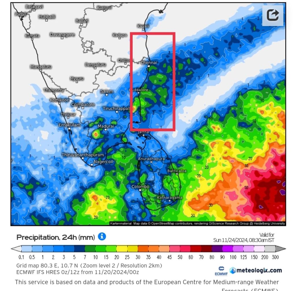
Meanwhile, the delta districts of Tamil Nadu have also been experiencing steady rains since last night, driven by moisture-laden easterlies.
Rainfall Outlook:
South and Delta Districts: Rainfall is expected to continue over South Tamil Nadu and the delta regions for the next 2–3 days but with reduced intensity.
North Tamil Nadu: Cool and dry weather will persist in northern districts, including the KTCC region (Kanchipuram, Thiruvallur, Chengalpet, and Chennai), due to a prevailing high-pressure area. However, light showers are likely from November 23, as moisture begins to approach the coast.
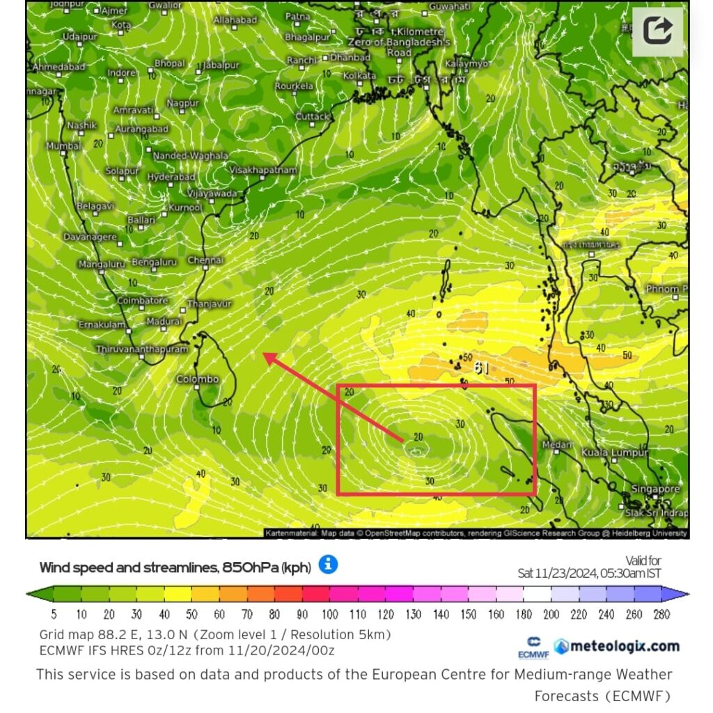
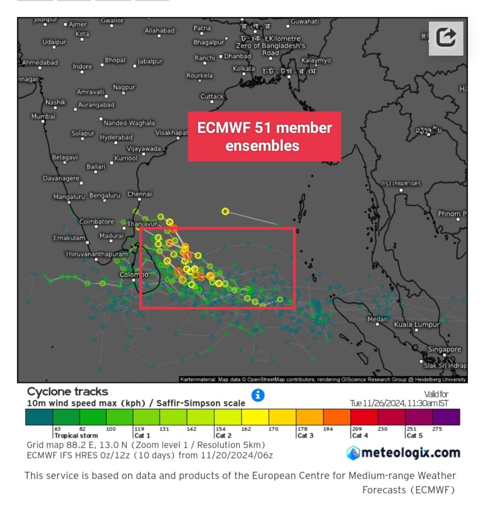
Potential Tropical Development:
A low-pressure area is likely to form near the Sumatra coast on November 23 and move westward, intensifying into a depression over the southwest Bay of Bengal by November 25. This system has the potential to develop further into a cyclone and may impact Tamil Nadu coast next week. Further updates will follow as the system evolves.