
Cyclone Fengal Brings Record-Breaking Rainfall Across Southern Peninsular India
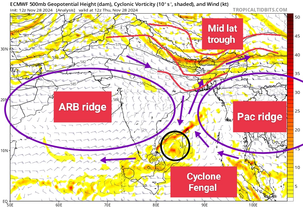
Cyclone Fengal was one of the most complex cyclones in recent years. It began as a low-pressure area over the southeast Bay of Bengal. Initially moving westward, it changed course after reaching Sri Lanka, shifting northwest in direction .The system encountered resistance between the Arabian Ridge and the Indo-Pacific Ridge, resulting in a sluggish movement until November 28. Eventually, it started to move towards towards Tamil Nadu from 29th nov ,making landfall near Pondicherry as a cyclone on 1st Dec. The landfall process was prolonged due to interplay of ARB and Indo-Pac ridges (which controls the steering of the cyclone) .After crossing Tamil Nadu, it has emerged into Arabian Sea now.
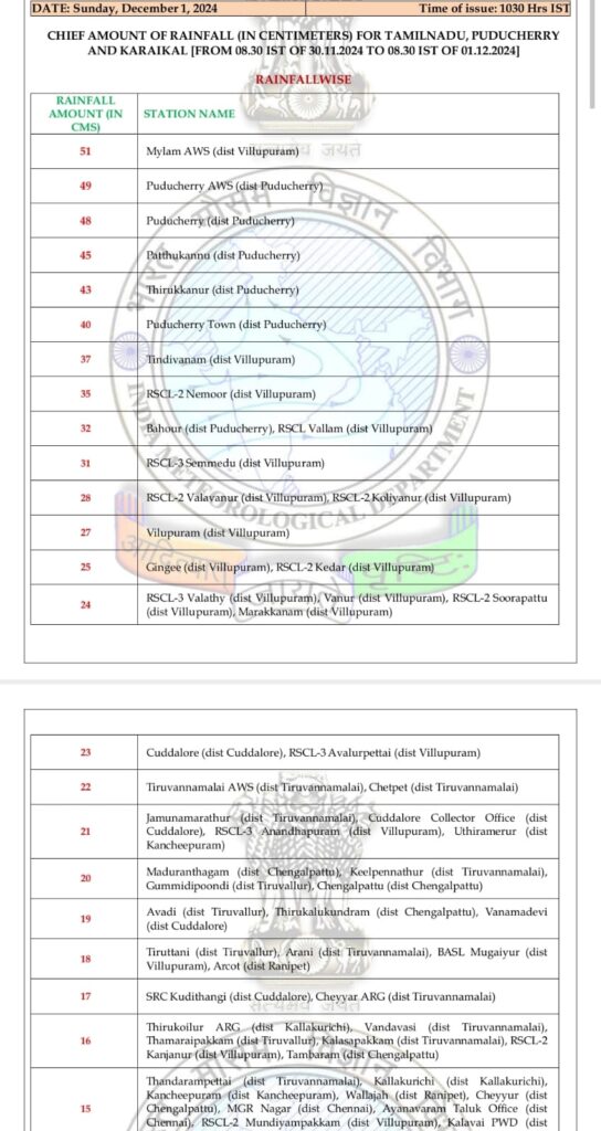
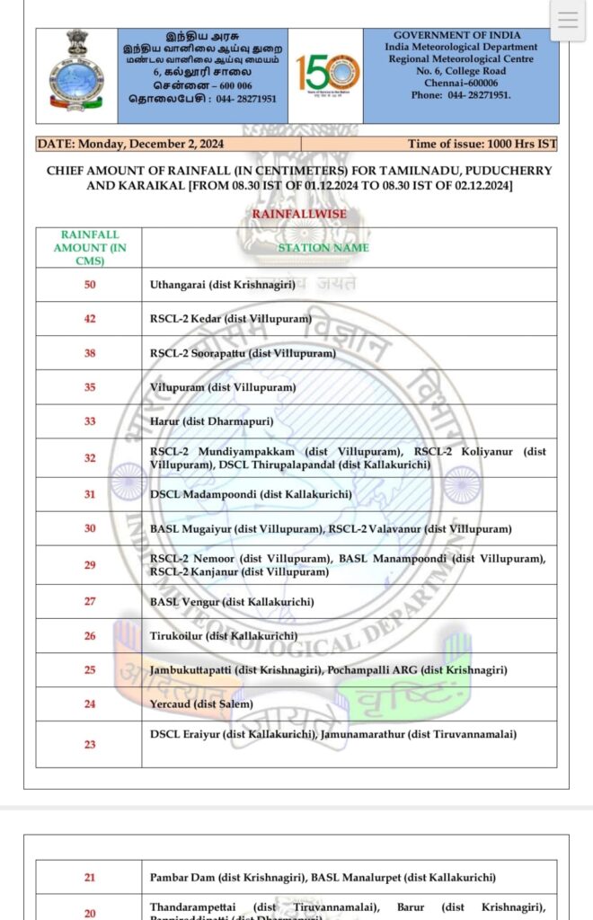
The cyclone’s slow progression led to unprecedented rainfall across Tamil Nadu, shattering numerous records. Pondicherry recorded 490 mm of rain in a single day, while Villupuram district received 600 mm in 36 hours. (Rainfall data courtesy- IMD)
What’s Next:
Numerical models suggest the development of a new low-pressure area over the southern Bay of Bengal by the second week of December, which may impact Tamil Nadu.
Forecast for Chennai and surrounding areas
Chennai and other parts of coastal tamilnadu will witness scattered rains mostly during night to morning due to moisture incursion from easterlies for next 2-3 days. Mostly dry weather to prevail post dec 6th over these districts.