
Rainfall Over Tamil Nadu Set to Increase From 14th October
Starting from 14th October, rainfall over Tamil Nadu is expected to intensify due to the development of a low-pressure area over the southern Bay of Bengal. This system is likely to move closer to the Tamil Nadu coast and intensify into a well-marked low-pressure area off the coast.
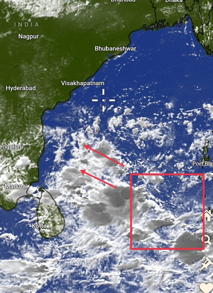
A broad trough is currently established over the southern Bay of Bengal, influenced by the Madden-Julian Oscillation (MJO) and the associated westerly wind burst (WWB).Multiple vorticities have been observed within this trough, and numerical weather models indicate that these vorticities are likely to merge into a single system over the southern Bay of Bengal. This system is expected to track towards Tamil Nadu, potentially strengthening into a well-marked low-pressure area. There is also a possibility that this low-pressure system may further intensify into a depression before making landfall along the northern Tamil Nadu coast around 16th or 17th October.
Heavy Rainfall Alert for Northern Tamil Nadu and Southern Andhra Pradesh. ⚠️
As the low-pressure area approaches, rainfall over the coastal regions of northern and central Tamil Nadu is set to increase from the morning of 14th October. The intensity of the rainfall will build throughout the day. On 15th and 16th October, heavy to very heavy rainfall is expected across districts in northern Tamil Nadu and southern Andhra Pradesh, particularly in areas such as Kanchipuram, Thiruvallur, Chengalpattu, and Chennai (KTCC region). Some isolated locations in these regions may experience extremely heavy rainfall during this period.
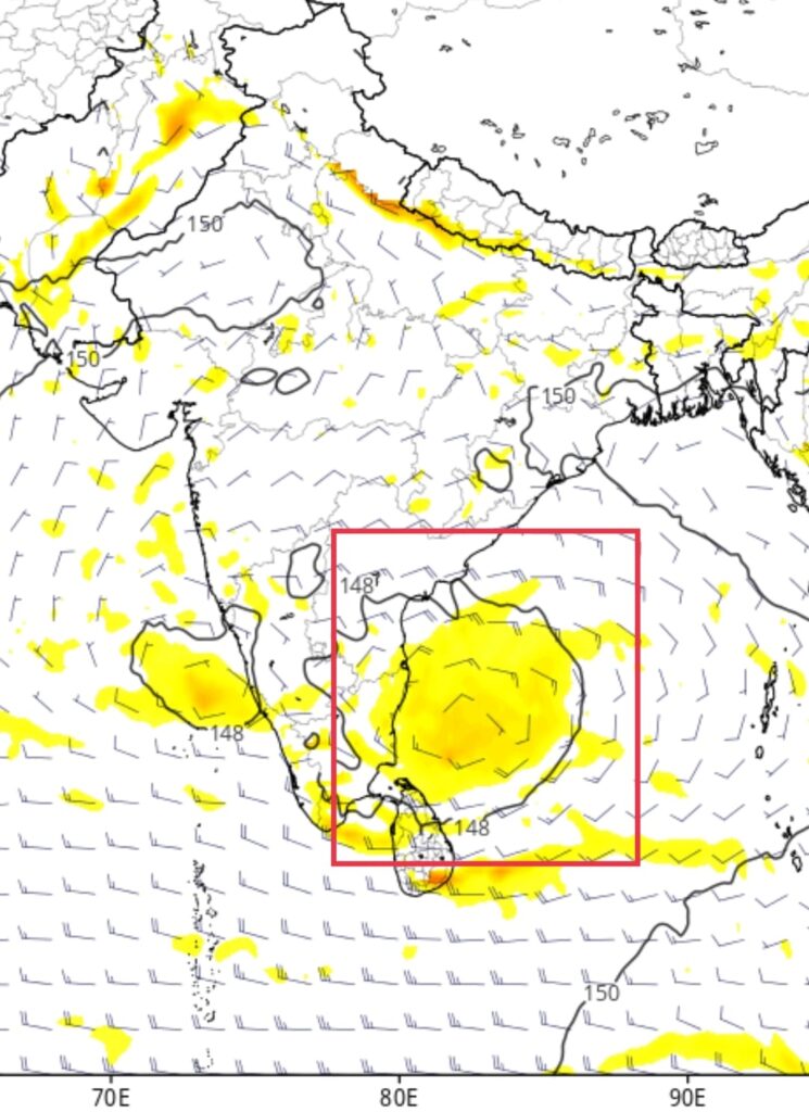
Conditions are favorable for withdrawal of southwest monsoon from remaining parts of country, with setting of easterly and northeasterly winds over southern peninsular India , Northeast monsoon rainfall is likely to commence in next 2 days over southern peninsular India