
Rains to continue with reduced intensity
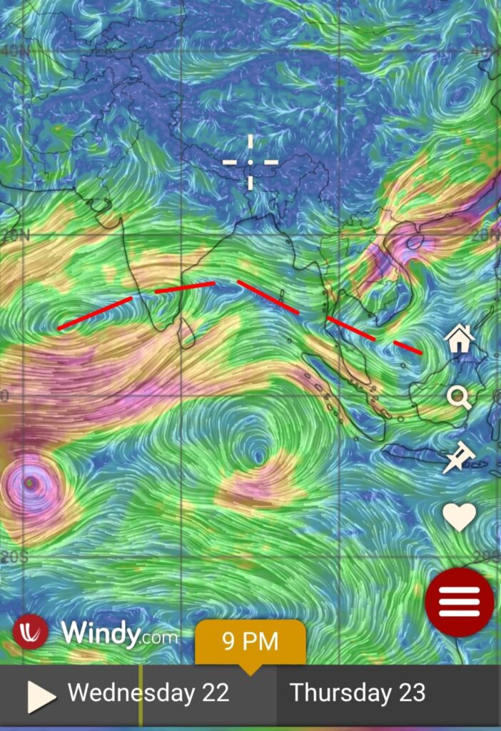
The well-marked low-pressure area over the southwest Bay of Bengal has moved north-northwestward and is now interacting with land. This system is embedded within a broad ITCZ zone, as seen in the satellite image.
Complex synoptic feature:
Numerical weather models indicate that the WML will likely merge into the ITCZ, with a fresh circulation expected to form over the west-central Bay by the 24th/25th of October. Additionally, remnant energy from the Andaman Sea is expected to merge into this system, bringing renewed rainfall activity over North Tamil Nadu and adjoining areas of South Andhra Pradesh. This new circulation has the potential to intensify into a well-organized system. However, numerical models are showing inconsistencies due to the interaction of multiple atmospheric wave dynamics — MJO and ERW — over the Indian Ocean. More updates will be shared as the situation evolves.

Rain Outlook:
Rainfall is expected to continue with intermittent breaks over North Tamil Nadu and South Andhra Pradesh for the next few days, with reduced intensity. As the new circulation develops over the west-central Bay, localized intense spells of rain are possible over North Tamil Nadu and South Andhra Pradesh toward the end of this week due to westerly convergence.
Chennai and its surrounding areas are likely to experience intermittent spells of rain, occasionally heavy, over the next 24–36 hours.