
Rains to start in Coastal Tamil Nadu as conditions turn favorable
System Movement and Current Status :
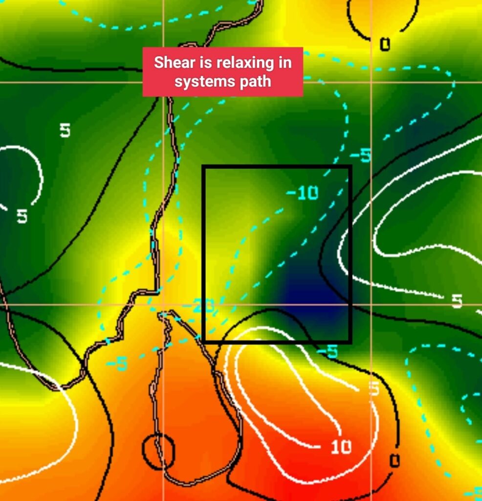
The deep depression over the southwest Bay of Bengal has moved north/northeast at a very slow pace over the last 24 hours. This movement has altered the system’s orientation, shifting rain-bearing clouds to its eastern periphery. Additionally, the system encountered relatively high vertical wind shear overnight, causing some disorganization.
However, the latest satellite images and data reveal that the vertical wind shear has now relaxed. As a result, intense convection is developing around the center of circulation, indicating that the system is strengthening and “breathing” better.
Forecasted Path and Landfall:
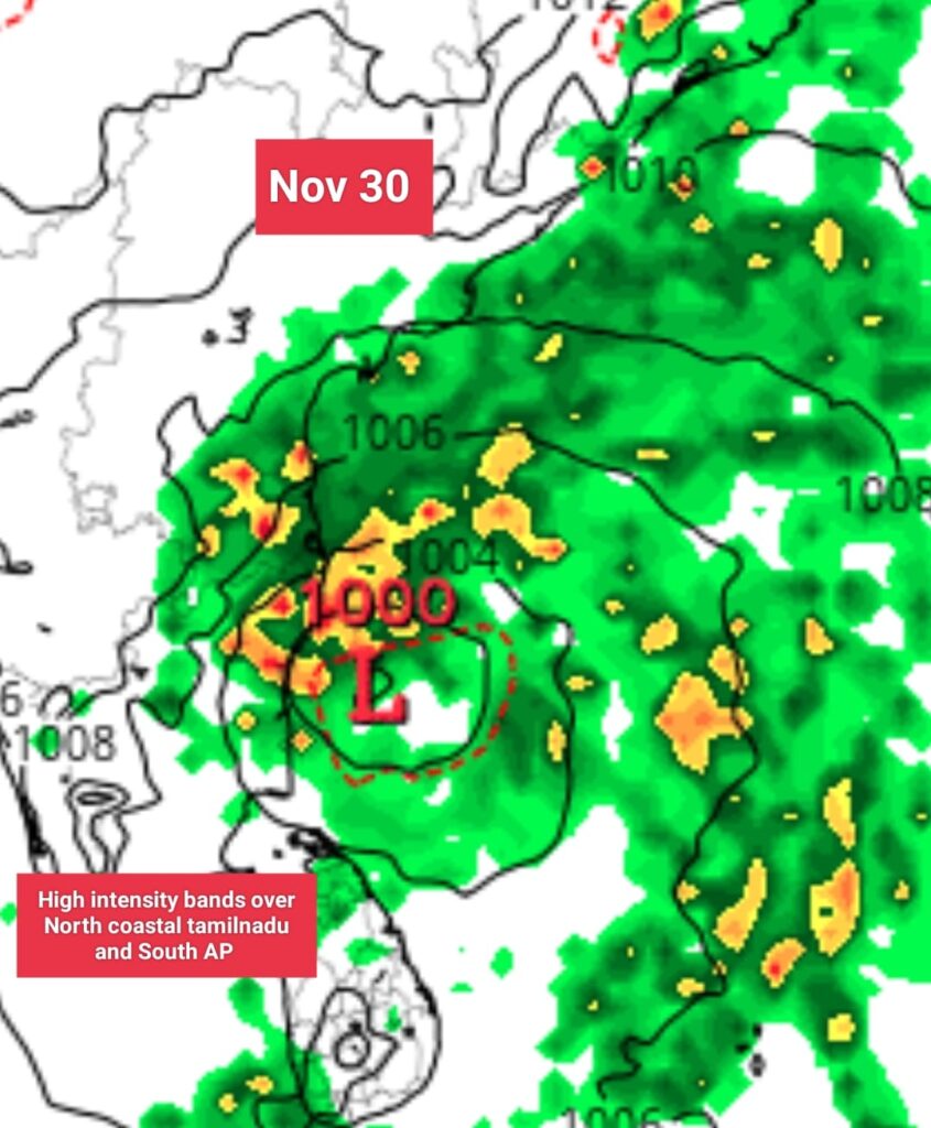
Numerical weather models suggest the deep depression will move west-northwest and is expected to reach the northern Tamil Nadu coast by the afternoon of November 30th. The system is likely to make landfall between Chennai and pondicherry as Deep depression/Cyclone on 30th Nov.
Heavy Rainfall Warning ⚠️
Under the influence of this synoptic feature and improving conditions:
Starting Tonight (November 28th): Rains are expected to commence over north coastal Tamil Nadu and southern Andhra Pradesh.
November 29th: Heavy to very heavy rainfall is likely from the afternoon onwards.
November 30th: Very heavy to extremely heavy rainfall is likely to occur over the KTCC districts (Kanchipuram, Tiruvallur, Chengalpattu, and Chennai) as the deep depression nears and crosses ⚠️
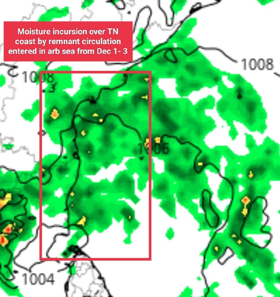
December 1st – 3rd: As the system enters the Arabian Sea, it will draw moisture from bay bringing additional rains to the Tamil Nadu coast, continuing until December 3rd.