
Well-Marked Low-Pressure Area Over Southwest Bay of Bengal: Rains to Intensify Over Tamil Nadu
Invest 99B
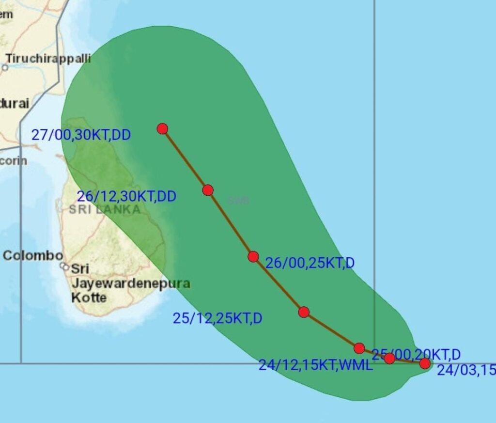
As of 06:00 UTC Nov 24, 2024:
Location: 4.2°N 86.1°E
Maximum Winds: 25 kt
Minimum Pressure: 1002 mb
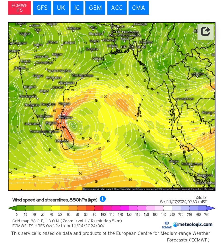
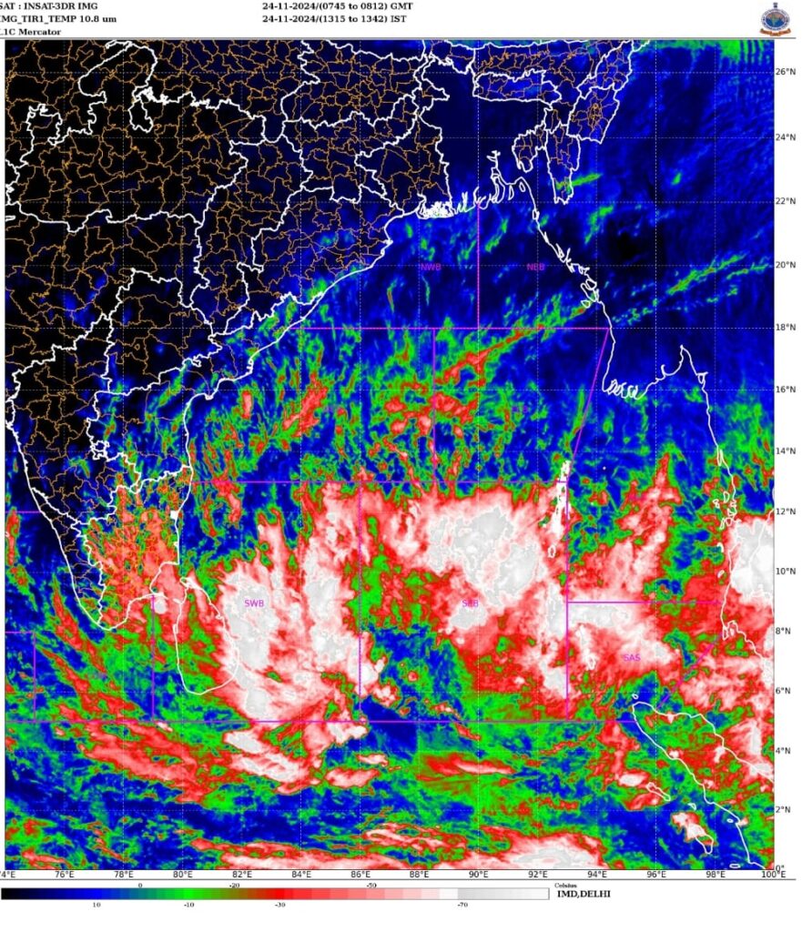
The low-pressure area over the South Bay of Bengal has moved west-north westwards and intensified into a well-marked low-pressure area over the Southwest Bay of Bengal. It is expected to strengthen further into a depression within the next 12-24 hours and move closer to Tamil Nadu coast by the morning of November 27th. There is a significant potential for this system to develop into a cyclone as well. However, the exact landfall location remains uncertain due to possible interaction of the system with incoming mid-latitude trough at the 500 hPa level over eastern India. We will have a clarity on landfall point as numerical weather models reach a consensus on the system’s track in a day’s time.
Rainfall Outlook:
- Delta Districts (Tamil Nadu)
Starting from November 25 (Night): Heavy rains are expected to begin.
November 26 onwards: Widespread heavy to very heavy rains are expected.
- North Tamil Nadu and SAP(including Kanchipuram, Tiruvallur, Chengalpattu, and Chennai Districts)
November 26 (Day): Moderate rainfall wil expected to commence.
November 26 (Night): Rainfall intensity will increase, with the potential for heavy downpours from November 27th onwards.
Rainfall intensity will also depend on the system’s proximity to the coast.
Further updates will follow as the system evolves.