
Rains expected to make a return
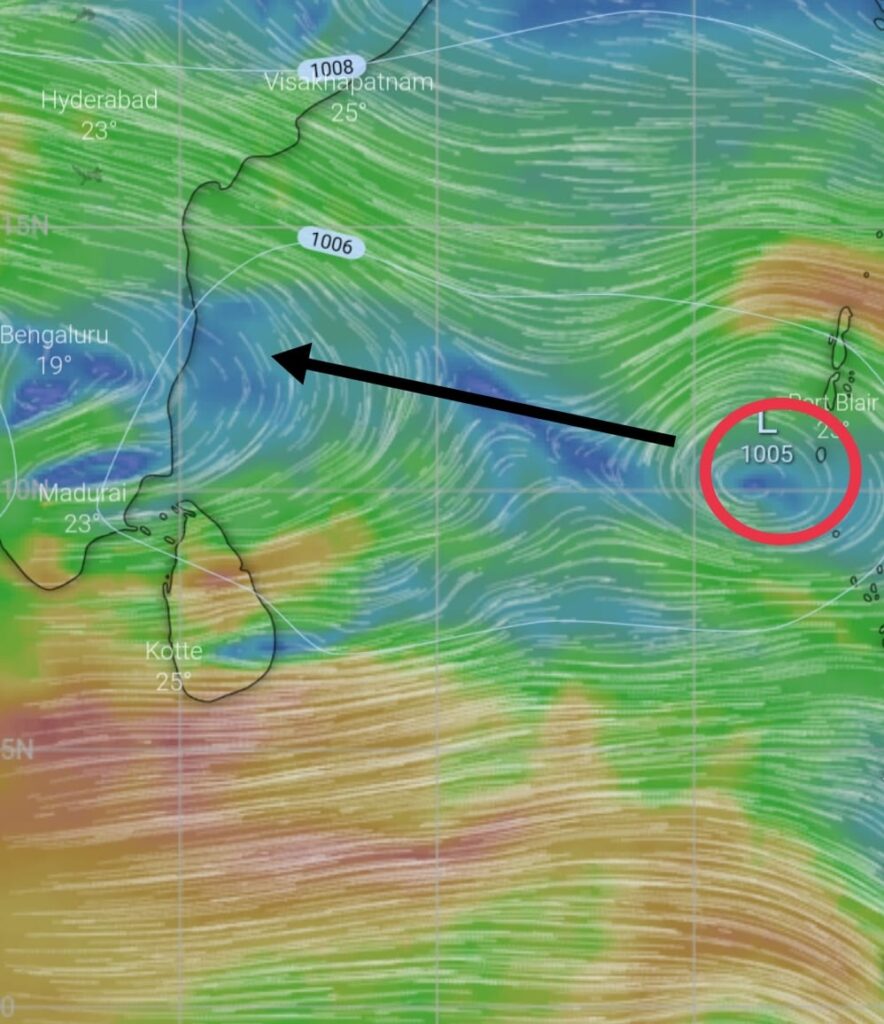
A low pressure area lies over North Andaman sea. Though it was expected to intensify into depression by now, it lacked proper divergence at upper levels leading to no intensification.
As the system didn’t intensify yet, it is expected to move mostly in a westerly direction and reach Central bay by Wednesday the 17th where the conditions seem little favorable for Intensification.
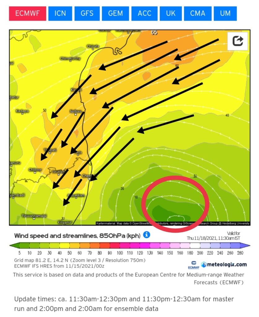
It will Intensify into Well marked low pressure (WML) area and reach South Andhra Pradesh – North Tamilnadu coasts by Thursday 18/11/2021.
Under the influence of the this system South Andhra Pradesh and North Coastal Tamilnadu is expected to start receiving rains from Wednesday evening (17/11/2021)
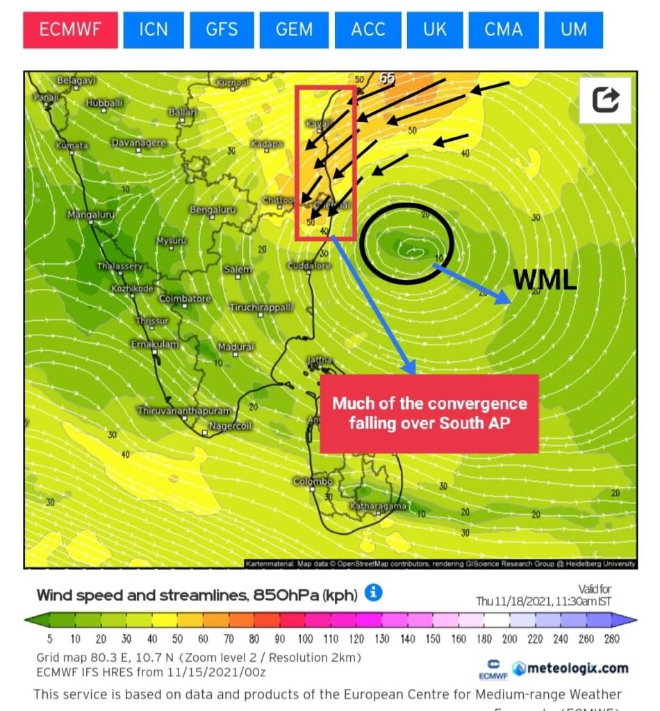
North Coastal areas of Tamilnadu including Chennai city will witness scattered intermittent showers from tomorrow late night (16/11/2021) as easterlies resume. The rains will increase as low pressure area closes in by Thursday (18/11/2021)
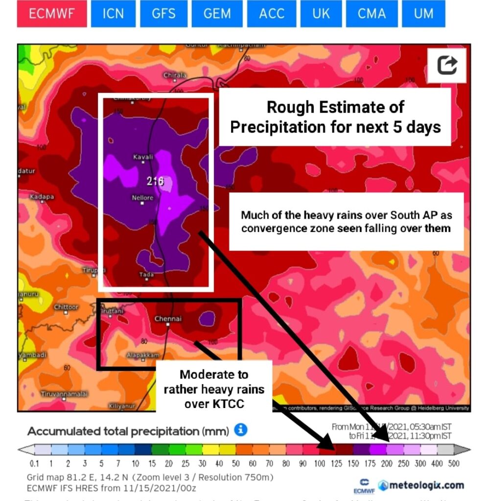
Moderate to rather heavy rains {4-7cms/day ( Rough estimate)} is expected on 17and 18 November over North-coastal areas of Tamilnadu.
Luckily, much of the rainfall is expected to fall over South Andhra as convergence will fall over that area due to the position of the LPA.
Rainfall will decrease from Friday evening as Low pressure moves away.
Chennai city
Chennai city will see scattered showers from tomorrow late night, which would turn fairly widespread from 17th November evening to 19th November morning as low pressure area approaches. The rainfall will be intermittent with moderate intensity, at times heavy.