Month End system to affect TN
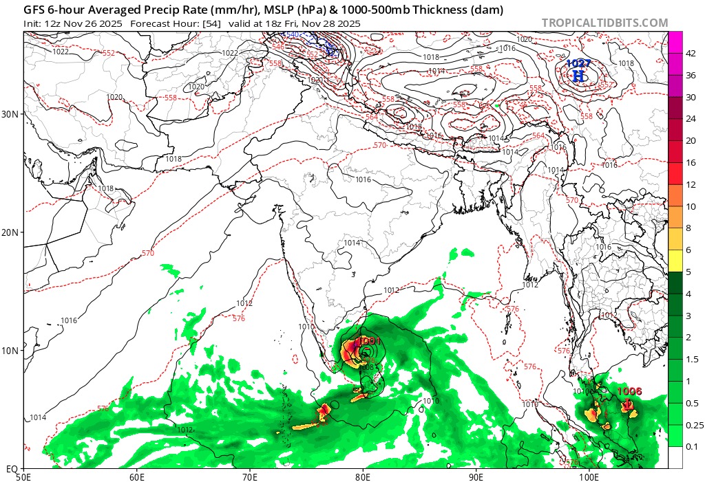
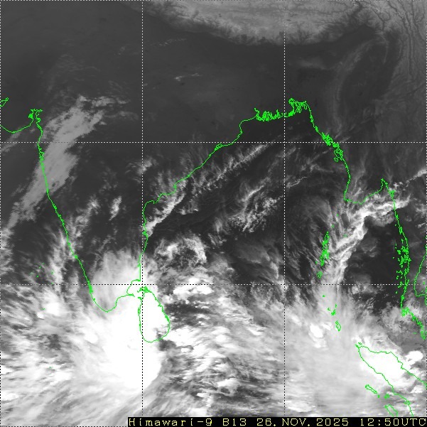
For the past few days, the atmosphere over the Bay of Bengal has been highly volatile, as a series of vortices embedded in a large east–west trough extending from the Southwest Bay to the South Andaman Sea have been causing chaos in model runs. Numerical weather models had a very tough time picking up the exact trend. The only model to sense this early was the ECMWF AIFS. It has been continuously picking the trend well, and now the ECMWF operational model and other models have slowly aligned to its view: the well marked low pressure over the Comorin Sea will relocate to the Southwest Bay of Bengal, intensify into a depression on 28 November, and move closer to the Tamil Nadu coast by 29 November, with an increase in intensity.In view of the approaching system, Increase in rainfall activity is likely over the tamilnadu coast starting from 28th November onwards over tamilnadu. Heavy to very heavy rains are very likely over delta. Chennai will start seeing good rains from 29th onwards.