
Rains to increase over coastal TN, admist formation of tropical storm over bay
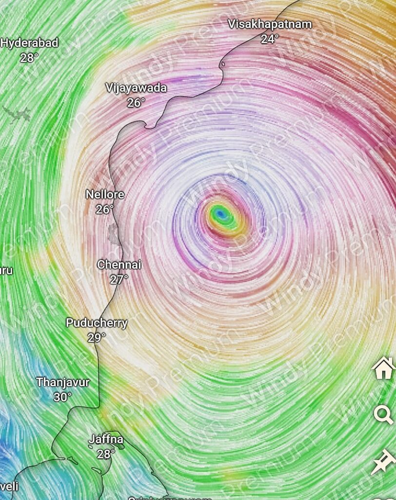
Increase in rainfall along the coastal and interior regions of Tamil Nadu likely as the easterly winds strengthen starting tonight. Over the next 3-4 days, widespread moderate to heavy, possibly very heavy rains are expected at isolated places Specifically, the districts of Kanchipuram, Thiruvallur, Chengalpattu, and Chennai (KTCC) are likely to witness moderate to heavy spell of rain, with some isolated areas experiencing very heavy rainfall over the next 48-72hrs
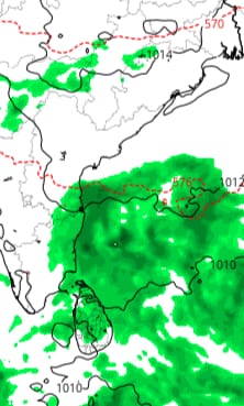
Bay to host a Tropical Storm
Simultaneously, Bay of Bengal is expected to host a tropical storm. Numerical weather models indicate the development of a low-pressure system in the south Andaman Sea, forecasted to concentrate into a depression and subsequently intensify into a cyclone by December 2nd. The track of this system is uncertain for now due to complex atmospheric dynamics involved, but consensus among models is anticipated by thursday or friday. Presently, the prevailing trend suggests the cyclone may pass 150-200 km off Chennai coast before moving towards South/Central Andhra Pradesh. So the impact to Chennai and other parts of TN will depend on the proximity of the system.
We will keep you updated as the situation evolves.