
MONSOON 2021 back on track
Last few days the performance of Southwest monsoon was sub-par over the country as there were no support systems on either of the basins to keep its muscles stronger and as a result break monsoon conditions firmed up over the sub-continent. This reduced the strength of westerly winds and the leeward regions like TN and southern AP were highly benefitted from the thunderstorm rains.
Southwest monsoon has this seasonal oscillatory behavior between active and break monsoon conditions. With a Low pressure area cooking in the Bay, it’s time for the monsoon to switch to its active conditions.
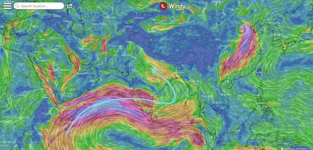
Strong monsoon surge is seen over the west coast of India as a result of the LPA. Extreme rains are very much possible over the south konkan coast during the next 2-3 days and as the low moves inland the rains are likely to get more concentrated over the western ghat areas as high velocity, moisture laden monsoon winds strike the peak. This results in moisture trap along the places closer to the ghats and eventually the skies open up to its full fury.
Not only the west coast is likely to get benefited, Extreme northern plains that have been searing under relentless heat for the last couple weeks can now look forward to the advance of SWM as the system pushes the moist easterly winds from the Bay of Bengal far into the deserted regions of Rajasthan.
Coming to TN, it’s going to be pretty silent on rain but nevertheless the monsoon surge can at least keep the temperatures under check over most places.