Northeast monsoon to set in with a bang over Tamilnadu and Andhra Pradesh coasts within 24-48 hours
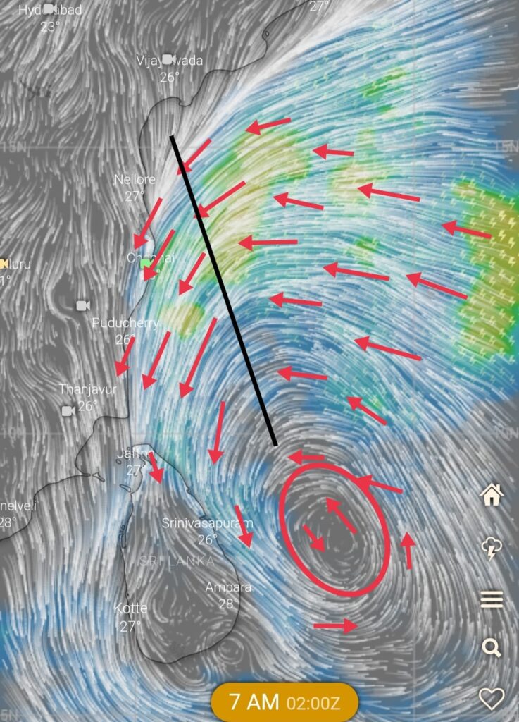
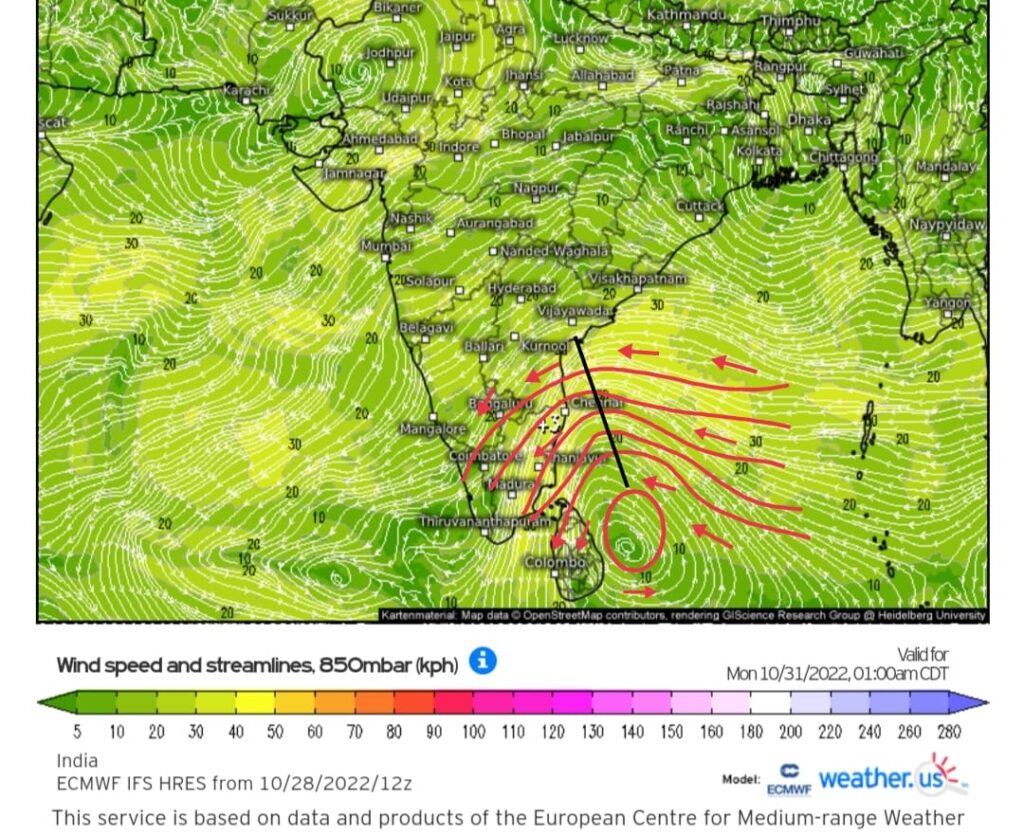
Finally the much awaited onset of NEM is very likely to happen over Tamilnadu and Andhra Pradesh coasts as inverted trough is seen moving towards coast. The approaching trough may deepen a bit over SW bay and will give sustained rains over coastal areas of Tamilnadu and Andhra Pradesh till November 5/6.
Top numerical weather models are in tight agreement that the IV trough’s axis is expected to fall over south AP/ North TN btw 31st oct and nov 1 , which could bring very heavy rains over these regions.
Rainfall is likely to pick up pace from today onwards over coastal as well as interior areas of Tamilnadu. Moderate to heavy rain likely over many places in coastal areas today and tomorrow the 30/10/2022.
As the IV trough approaches , the rainfall is expected to increase from 31st early morning. Heavy to very heavy rains are expected over North coastal Tamilnadu and South AP till November 4/5.
Chennai and ktc forecast.
Intermittent spells of rains likely throughout the day with increased intensity and duration during night time for next 2 days. The rainfall activity will further increase from 31st October. Heavy rains likely in many places over these regions.
What happened to the expected window of onset by moc.
Even though numerical weather models indicated monsoon to set in between 21-23 October, all criteria which is required to declare onset of monsoon wasn’t met. So there was no declaration from official agency.