
Rains to pick up over TN
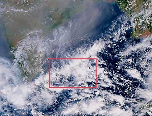
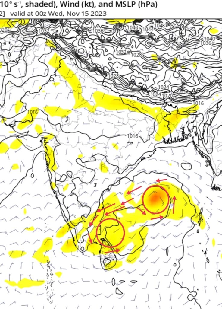
A trough is seen taking shape over Southwest bay of bengal which is poised to bring heavy rains over coastal Tamil Nadu including KTCC (Kanchipuram, Thiruvallur, Chengalpattu, Chennai) districts between 13th night and 16th early morning.
Another low is likely to form over North Andaman sea in same time frame which may turn into an organized system. As per the numerical weather models forecast this system will get caught under approaching westerly trough over North india, and move in Northeast direction away from Tamil Nadu . Also this system will pull the existing trough over southwest bay as well post 16th November.
So the period between November 13th night to 16th morning remains crucial to get as much as we can from the trough over Southwest bay.
Coastal Tamil Nadu will see scattered rains from 13th late-night which will pick up from 14th and it will last till early 16th of Nov.
Chennai and surrounding areas will see intermittent rains, at times heavy between 14th and 16th november early morning.
Long Range:
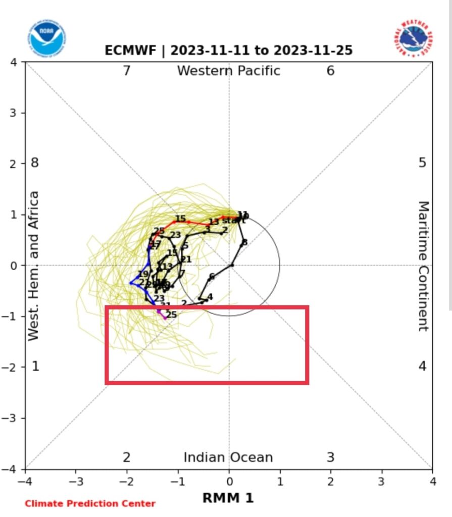
As per top weather models guidence Northeast Monsoon will pick up its pace over TN from last week of november as MJO may move into Indian Ocean and suppression from strong positive IOD may weaken.