LPA forms in South Andaman Sea, likely to intensify into a Cyclonic storm
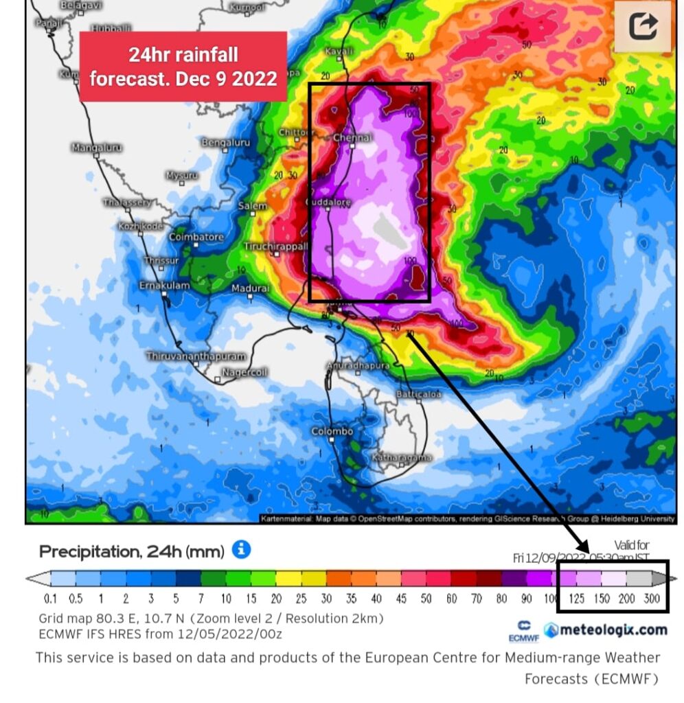
CYCLONE WARNING ⚠️ FOR NORTH TAMILNADU INCLUDING SOUTH ANDHRA PRADESH COASTS (Dec 8-10)
As expected by Numerical weather models , a low pressure area has formed over South andaman sea this morning. It is like to move in westerly direction and intensify into depression in next 24 hrs and subsequently into CYCLONIC STORM in next 48-60hrs. It will be named ” MANDOUS” once it attains cyclone strength. ( Name given by UAE)
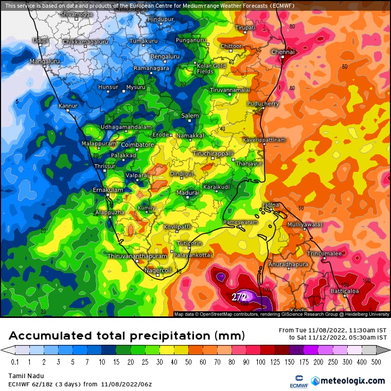

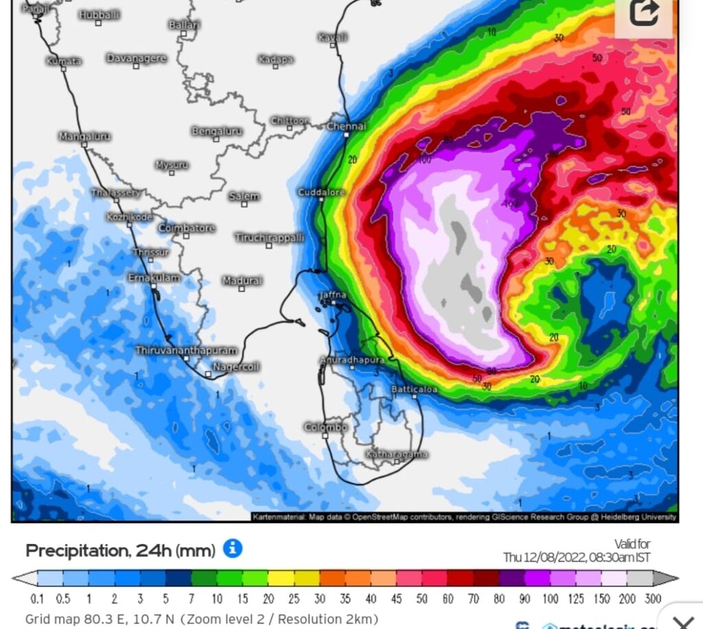
It is likely to near North Tamilnadu coasts by 9th dec morning/afternoon. Heavy to very heavy rains with isolated extremely heavy rains are likely over North Tamilnadu including KTCC districts from 8th december afternoon/evening.
🚨 Squally wind speed reaching 50kmph is likely to commence over North Tamilnadu coasts from 8th December evening and will reach 70-80kmph on 9th December.🚨
🌀This Cyclonic storm has good chances to intensify into Severe Cyclonic storm in southwest bay of bengal before weakening close to coast due to shear.
🌀This Cyclone will be rainfilled one as there is dual moisture support ,one from South China sea and another from Cross Equatorial westerly flow (CEW)and not
like last system which was empty shell due to dry air factor affecting it since its birth. Also rain bands are seen penetrating well into coast..