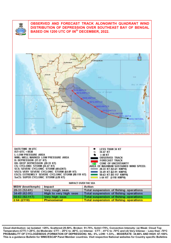
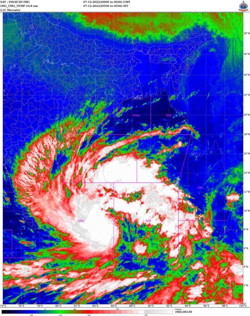
LPA over bay intensifies into a depression, Cyclone likely by today evening
Well marked low pressure area over South Bay of bengal has concentrated into Depression. ( Tropical cyclone warning ⚠️ for North Tamilnadu including South AP coasts)
Invest 96B
As of 12:00 UTC Dec 06, 2022:
Location: 8.3°N 87.3°E
Maximum Winds: 30 knots.
Minimum Central Pressure: 1000 mb.
It is like to move in West-Northwest direction and intensify into CYCLONIC STORM “Mandous” in next 24hrs. Thereafter it will continue to move towards North Tamilnadu adjoining South Ap coasts.
North Tamilnadu including Chennai city and adjoining South Ap coast will start seeing its impact from 7th December midnight or 8th December morning onwards. Winds are expected to gradually increase from 7th midnight and rains from 8th morning/afternoon over these regions.
Heavy to very heavy rains are expected over North Tamilnadu including KTCC districts from 8th December. Wind speed reaching 50-60 kmph , gusting to 80kmph likely over North Tamilnadu coasts from 8th dec evening.