Cyclone Michaung leaves a trial of destruction
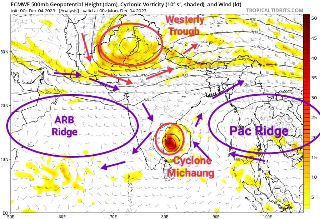
Tropical Cyclone Michaung is a powerful example of a storm that faced minimal obstacles during its formation, getting stuck between sub tropical ridges close to the coast. Even though its main path was towards Andhra Pradesh, Michaung moved slowly near Chennai, causing significant impact in the region.
This cyclone was quite a puzzle for numerical weather models and bloggers alike, starting its journey over the South Andaman Sea. The complexity of atmospheric dynamics and the influence of successive westerly troughs over Northern India kept the projected track changing regularly due alterations in ridge positions. Despite the daily fluctuations in model outputs, a combination of model ensembles and bloggers managed to predict its likely path through trend analysis.
Since the beginning, Cyclone Michaung had favorable conditions – a strong Madden-Julian Oscillation in phases 3 and 4, moist easterlies from the South China Sea, and low vertical wind shear. These factors led to rapid intensification near the coast, consolidating the storm by December 3. Positioned near North Coastal Tamil Nadu, the cyclone barely moved, trapped between subtropical ridges.
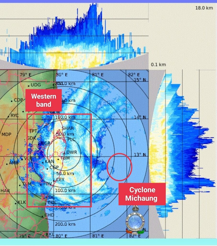
On December 3 at 9 p.m., the western band of the storm expanded over KTCC districts, starting a continuous spell of rain. Intense cells embedded in the western quadrant resulted in heavy downpours in Chennai and nearby areas, with wind gusts reaching 90 km/h. This persistent rainfall was fueled by increased upper-level divergence caused by an incoming Westerly Trough over Northern India. Chennai and surrounding areas experienced exceptional rainfall, reaching 500 mm or more in just 2.5 days, leading to severe flooding.
As Cyclone Michaung moved northwestward and made landfall over South Andhra Pradesh, the expectation is for a gradual reduction in rainfall over Chennai—a considerable relief for the city and its surroundings.