Transition rains to lit up interiors of South Peninsula
During Northern Hemisphere summer, Indian sub-continent heats up more than surrouding oceans, thereby creates a land-ocean (low-high) pressure grandient. Winds blow from high pressure (ocean) to low pressure (land), bringing in moisture laden clouds towards the land, and sets up the South West Monsoon season for India from June to September. During early October, as the land starts to cool down in Northern Hemisphere, the same pressure gradient reverses(land is cooler now, pressure will be high, ocean is still warmer and pressure will be low). Winds start blowing from land(Siberian High) onto ocean/sea (South China Sea, Bay of Bengal and Arabian sea) and sets up North East Monsoon from October mid to December.
Transition period is the time during which the wind reversal is slowly established from westerlies to easterlies. As the monsoon dynamics change from SWM to NEM, it also means that, the ITCZ (Inter Tropical Convergence Zone) is retracted back towards Equatorial/Torrid Zone on its transit to the Southern Hemisphere. During this time, the wind patterns in south Peninsular India is highly unstable, westerlies remain weak, and easterlies looking to make inroads, creating violent and conducive atmosphere for thunderstorms to occur in the interiors of the Peninsula (predominantly).
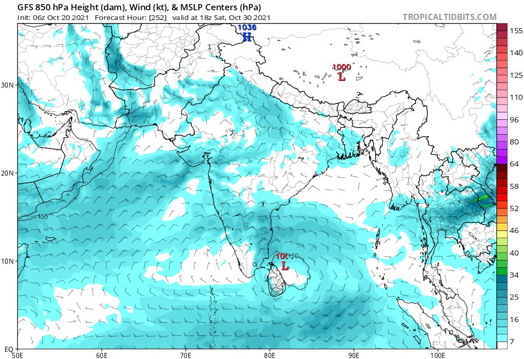
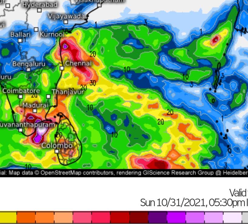
We are currently in this period now, with SWM drawing to a close across most of India. Further withdrawal of SWM from remaining parts of India until 15N latitude will happen in next three days. A cyclonic circulation is seen over South Tamilnadu coast and it is expected to persist for next 2-3 days. This feature is going to set up explosive environment for thunderstorms in South Peninsula. Wind patterns are weak with easterly component to it, which draws moisture from near seas and sustain rains for next 3 days or so. Heavy rains are forecast for interior TN, Kerala and South Interior Karnataka in due course. Early next week, model consensus indicates arrival of easterlies in Bay of Bengal. Promptly, the official agency has put out NEM onset watch for 26th October by when the easterlies strengthen in Bay at lower tropospheric levels. NEM behavior is very hard to decode and highly dynamic, but, early forecasts indicate a good start to the monsoon atleast for now. With SWM having done its job perfectly, the baton is now on NEM’s hands to take over and provide the riches.