Monsoon activity to pick up next week
As NEM on brake phase over TN now, weather models picked another active phase coastal TN as well as interior TN from 19th. As usual there is no consensus yet among the weather models, which means intensity of the cyclonic circulation and the precipitation over land.
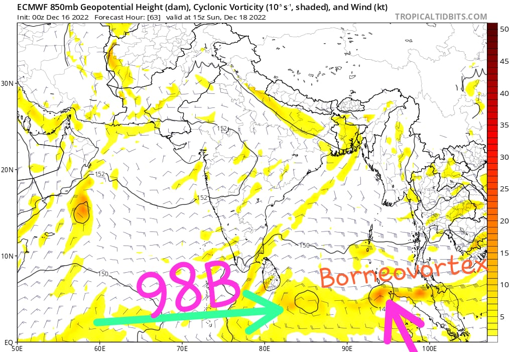
1. ECM picking SE bay circulation(98B) and Borneo vortex later its intensified the Borneo vortex near Sri Lanka coast
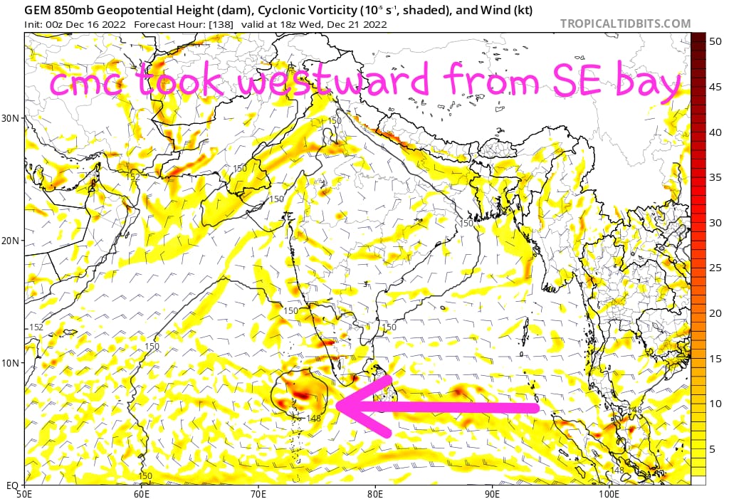
2. GFS, GEM both do not pick Borneo vortex, instead they pick SE bay cyclonic circulation alone (98B), GFS took the circulation little North of Srilanka whereas GEM took the circulation moving westward towards Arabian sea without any further intensification.
Without any clear consensus among models we can’t able to say which places are going to get rains.
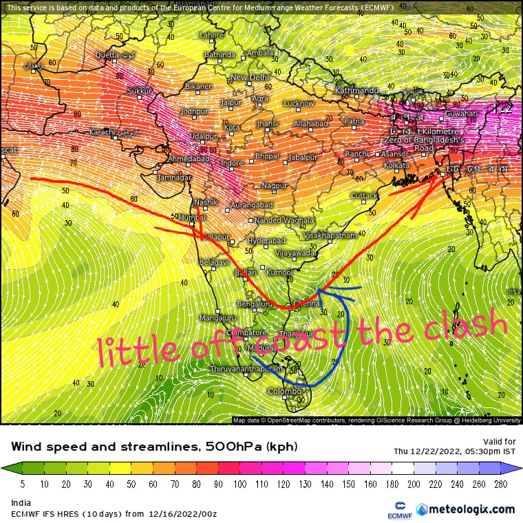
And one more heavy rain event picked by models earlier it was Westerly trough and Easterlies interaction, ECM showing the event may happen over off coast, Its not easy for weather models to pick the exact location where the clash going to happen. We have to wait few more days to get an clear idea about which places are going to get benefit from 98B.