Monsoon to ride rash on Low Pressure impetus
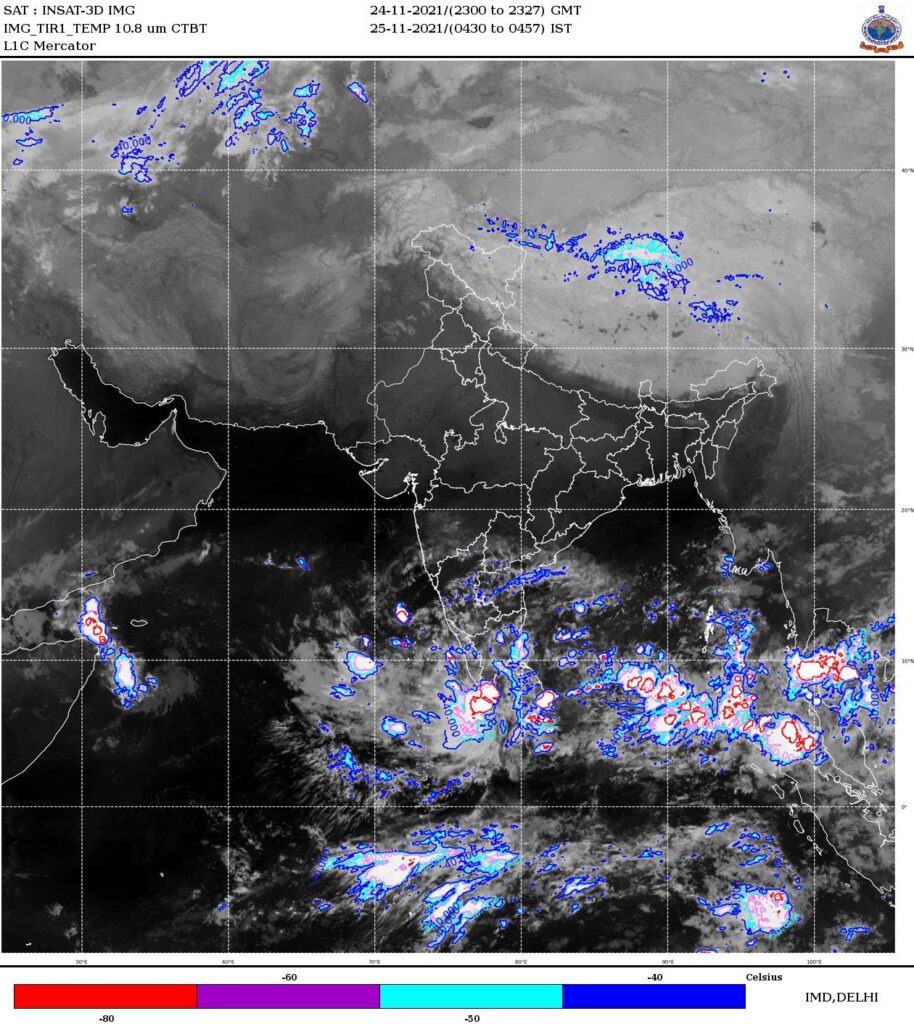
Low Pressure areas/easterly troughs are generally associated with cloudiness and inclement weather, as they bring with it moist air and strong convection. At this time of the year, when the ocean/sea is warmer than the surrounding land (as is the case with Bay of Bengal and South Peninsular India), low pressure areas are repeatedly churned out in NEM season which runs from October to December. Currently, a Low Pressure area is in formative stage over South West Bay of Bengal as the predecessor ‘cyclonic circulation’ descends down to surface levels. As the forecast indicates, this low pressure area (LPA) is going to stay for next 4-5 days in South West Bay of Bengal off Srilanka coasts. Location of this LPA is of greater significance now, because its causing moist winds from SW BoB to crash into North Tamilnadu (NTN) coasts and the offshore convergence and associated trough along the coastline is going to play pivotal role in ushering in the wettest spell of this year’s NEM.
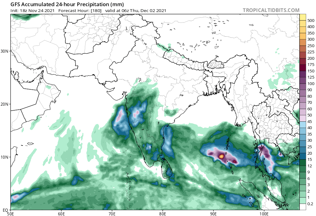
Tamilnadu is already riding on hefty NEM bounties and upcoming spell of rains is only going to propel the already gargantuan monsoon tally to newer heights. Parts of Delta and South Tamilnadu has already seen the dress rehearsal of what is to come yesterday. As far as today is concerned, the rain belt is going to cover entire NTN coasts from Kodiyakkarai to Chennai. Rains will come in numerous spells and some of them will be very intense. Delta and Pondy/Cuddalore surroundings in particular will see heaviest falls. Places above Pondicherry (including Chennai) will see intermittent rains today and some places can get heavy rains as well. From tomorrow onwards, Chennai and surroundings can expect very heavy falls as the convergence shifts further North.
And more rains will continue into the weekend, by when the full blown easterlies scuttle through the northern parts of the state. Since the rain spell is going to linger for next several days, it has become crucial to understand the aftermath of this, especially when all rivers are in full flow and soil saturation was attained long back. Waterlogging eventualities are foreseen in most parts of Chennai in upcoming days and the city needs to stay resilient through the course and brave this inclement weather.
Interiors of North TN and most of South TN will see light rain showers at times but major rains are not forecasted for next 4-5 days. But models are indicating a slight increase in rains in these places, once the system moves to Arabian sea.